Maps are more than just pictures of land and sea. They are windows into how humans once understood the world . Ancient maps, created hundreds and even thousands of years ago, shaped our perception of Earth and the way we explored it. Let’s dive into this fascinating journey through history.
The Earliest Maps: A Human Need to Navigate
Humans have always needed to know where they are and how to get somewhere. The earliest maps were not like the ones we use today. They were often drawn on clay tablets, animal skins, or even walls. These maps were simple, showing rivers, mountains, and settlements.
For example, in Babylon around 600 BC, there was a clay tablet map showing the world as a flat disk surrounded by water. People may laugh at it now, but at that time, it represented all the knowledge humans had.
How Ancient Maps Reflected Beliefs
Maps weren’t just practical—they showed beliefs. Many maps were influenced by religion, myths, or politics. The “T-O maps” in medieval Europe, for example, divided the world into three parts: Asia, Europe, and Africa. Jerusalem was often at the center.
This wasn’t about accuracy—it was about perspective. The maps told people: “This is how we see the world and our place in it.”
The Role of Exploration in Changing Maps
As explorers traveled further, maps had to evolve. Ancient maps were updated slowly, often with errors and guesses. When Marco Polo returned from Asia, Europeans updated their maps to include new lands and trade routes. ️
These maps made the unknown less scary. They gave people a sense of connection across continents. Slowly, humans realized that Earth was much larger and more complex than previously thought.
The Importance of Ancient Chinese Maps
China was also creating amazing maps long before Europe caught up. During the Han Dynasty (206 BC – 220 AD), detailed maps were drawn that included mountains, rivers, and roads. Chinese cartographers used grids, almost like modern latitude and longitude. This was revolutionary because it allowed accurate scaling and distance measurement.
| Feature | Babylonian Maps | Chinese Maps | Medieval European Maps |
|---|---|---|---|
| Material | Clay tablets | Silk, paper | Parchment, vellum |
| Accuracy | Low | Moderate | Low |
| Influences | Religion & Myth | Observation & Surveys | Religion & Myth |
| Purpose | Knowledge & Navigation | Administration & Travel | Spiritual & Political |
Maps and the Age of Discovery
The 15th and 16th centuries brought the Age of Discovery. Maps changed dramatically. Cartographers like Gerardus Mercator created the famous Mercator Projection in 1569. This projection made it easier for sailors to navigate by sea, even though it distorted the size of continents.
Maps were no longer just art—they were tools for trade, conquest, and science. Nations used maps to claim territories. Maps became power.
How Ancient Maps Influenced Modern Thinking
Even today, ancient maps shape our thinking. They remind us that our knowledge is limited and constantly evolving. Ancient maps helped scientists and explorers question old ideas. For example:
-
The idea of a flat Earth was challenged gradually.
-
Understanding continental shapes eventually led to theories like plate tectonics.
-
Mapping rivers and mountains helped in planning cities, roads, and trade routes.
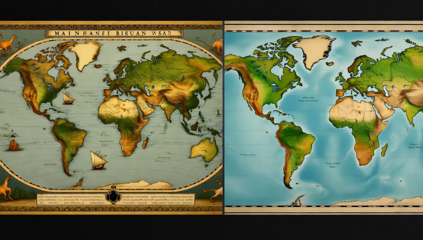
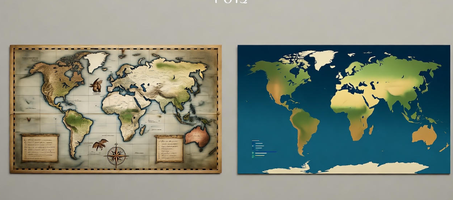
Unique Features of Ancient Maps
Ancient maps often included strange or artistic elements that modern maps don’t:
-
Sea monsters in oceans, showing danger and imagination.
-
Imaginary lands, like the Island of California, based on traveler stories.
-
Compass roses and decorative borders, turning maps into artworks.
These elements tell us something important: humans have always combined knowledge with creativity.
Lessons from Ancient Maps
Studying ancient maps teaches us patience and curiosity. People spent years compiling observations, talking to travelers, and slowly building a picture of the world. Even when wrong, these maps were stepping stones for understanding Earth.
| Lesson | Explanation |
|---|---|
| Observation Matters | Ancient cartographers collected real-world data, showing the power of careful observation. |
| Knowledge Evolves | Maps changed as humans explored more. Mistakes were corrected over time. |
| Creativity Helps | Art, stories, and imagination made maps engaging and memorable. |

FAQs About Ancient Maps
Q1: Were ancient maps accurate?
Not always. Early maps often mixed fact with myth. But even inaccurate maps were useful—they guided travelers, taught geography, and inspired exploration.
Q2: Which is the oldest known map?
The oldest known map is from Babylon, around 600 BC, drawn on a clay tablet. It showed a flat Earth surrounded by water.
Q3: Why did medieval maps put Jerusalem at the center?
Maps reflected the worldview of the mapmakers. Jerusalem was the religious and cultural center of Europe at the time, so maps placed it at the heart of the world.
Q4: Did ancient maps influence modern cartography?
Absolutely! Many modern techniques, like grids, scale, and projections, were inspired by ancient maps. Without them, we wouldn’t have accurate maps or GPS today.
Q5: Can we see ancient maps today?
Yes! Many ancient maps are preserved in museums and libraries. The British Library, the Library of Congress, and other institutions hold famous historical maps.
Conclusion: Seeing Earth Through Ancient Eyes
Ancient maps are more than tools—they are stories. They show us how humans tried to make sense of a vast, unknown world. They reveal imagination, exploration, and discovery.
Next time you look at a modern map on your phone, remember: centuries of curiosity and creativity made it possible. Ancient maps changed the way we see Earth—not just physically, but in our minds too. ✨